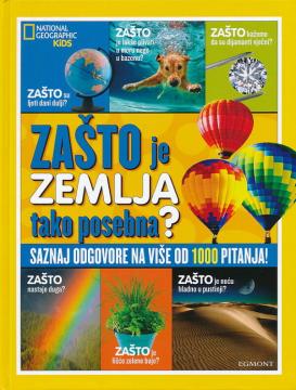
Zašto je Zemlja tako posebna?
Warum entstehen Regenbögen? Warum sind Blätter grün? Warum dreht sich die Erde am Äquator am schnellsten? Warum kann man keinen Weg zur anderen Seite der Erde graben? Warum ist das Meer salzig? Warum fragen wir nach dem Warum? Weil wir immer etwas Neues l
Es gibt keine dummen Fragen! Ob lustig, seltsam, ernst oder belanglos – alle Fragen verdienen eine Antwort. In der Sammlung „Warum?“ werden die Antworten mit Expertenwissen untermauert und durch tolle Fotos ergänzt! Spannende Fragen und noch spannendere Antworten regen Kinder zum Nachdenken und Suchen an und werden sicherlich auch viele Eltern interessieren.
Titel des Originals
National geographic why: our planet
Übersetzung
Duško Čavić
Editor
Karla Bareta Grgić
Maße
28 x 21 cm
Seitenzahl
31
Verlag
Egmont, Zagreb, 2019.
Latein Schrift. Hardcover.
Sprache: Kroatisch.
Angeboten wird ein Exemplar
Zustand:Gebraucht, in ausgezeichnetem Zustand
Zum Warenkorb hinzugefügt!