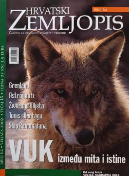
Hrvatski zemljopis # 62 - veljača 2002: Vuk između mita i istine
Angeboten wird ein Exemplar

Angeboten wird ein Exemplar
Interessieren Sie sich für ein anderes Buch? Sie können das Angebot über unsere Suchmaschine suchen und finden oder Bücher nach Kategorien durchsuchen.
Vodič sa 53 fotografije, 2 skice i preglednom kartom u boji.
A geography textbook for all continents (except Europe) intended for lower grades of secondary schools in the Independent State of Croatia. The work of the prominent Croatian geographer and pedagogue Ivo Juras, illustrated with interesting black-and-white
School atlas by Anton Emanuel Seibert for civic and multi-grade elementary schools, published in Vienna around 1901. Contains 19 main and 12 auxiliary maps of Europe and the world, as well as depictions of Austria-Hungary.
An encyclopedic handbook for school and every home. More than 500 pages, 200 maps and more than 500 photographs and illustrations. Rich and varied geographical, historical and economic content in encyclopedic format.
WHY do rainbows form? Why are leaves green? Why does the Earth spin fastest at the equator? Why can't they dig a path to the other side of the earth? Why is the sea salty? Why do we ask why? Because we always want to learn something new!