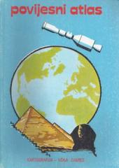
Hrvatski povijesni zemljovidi

Hrvatski povijesni zemljovidi

Josip Lučić, Franjo Šanjek, Ljubomir Antić, Branko Vidaček, Ivan Bertić

Historical maps of Croatian states.

Prehistoric sites on Croatian soil Romans on Croatian soil Croatia in the age of princes (Trpimir's Croatia around 845 to 864) Croatia for King Tomislav Croatia in the second half of the XI century. century (for King Petar Krešimir IV around 1073) Croatia in the second half of the XIII century. St Croatia in the second half of the 14th century. St (after the Peace of Zadar in 1358) Croatia on the eve of the Battle of Mohacs (1526) "Croatia revived (from the 17th to the end of the 18th century) Croatia at the time of Napoleon's conquests Croatia at the end of the 19th century. St. Croatia 1918 – 1920 Banovina Croatia (1939) Independent State of Croatia (1941-1945) The Republic of Croatia in Yugoslavia (1945 to May 1990) Republic of Croatia (January 17, 1997)

Urednik
Vera Muller
Ilustracije
Božica Mihaljević, Marija Perečinec, Đurđica Sporiš, Vladimir Vuković, Miroslav Rapo, Tihomir Štivičić
Naslovnica
Tomislav Žnidarec
Dimenzije
24 x 29 cm
Broj strana
88
Nakladnik
Učila - Kartografija, Zagreb, 1993.
 
Latinica. Broširano.
Jezik: Hrvatski.
ISBN
9-53-602300-8

Nema primjeraka u ponudi

Poslednji primjerak je nedavno prodan.
 

Zanima Vas i neka druga knjiga? Možete pretražiti našu ponudu pomoću tražilice ili prelistati knjige po kategorijama.

Možda će Vas zanimati i ovi naslovi

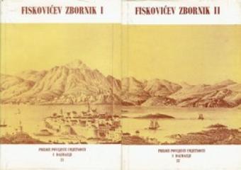
Fiskovićev zbornik I-II : zbornik radova posvećenih sedamdesetogodišnjici života Cvita Fiskovića

Fiskovićev zbornik I-II : zbornik radova posvećenih sedamdesetogodišnjici života Cvita Fiskovića

Branko Kirigin, Marin Zaninović, Jasna Jeličić, Emilio Marin, Nenad Cambi, Nikola Jakšić, Nikša P...

A collection of papers dedicated to the seventieth anniversary of the life of art historian Cvito Fisković.

Književni krug, 1980.
Hrvatski. Latinica. Tvrde korice s ovitkom.
Knjiga se sastoji od dva toma
12,00 - 25,46 €
Povijesni atlas

Povijesni atlas

Josip Lučić

The author worked on the creation of historical atlases and maps that showed the development of Croatian lands through the centuries.

Učila - Kartografija, 1982.
Hrvatski. Latinica. Tvrde korice.
5,98 €
Iz dalekog svijeta i susjednih zemalja: zemljopisna čitanka

Iz dalekog svijeta i susjednih zemalja: zemljopisna čitanka

Zvonimir Petek

This educational geography reader by Zvonimir Petek offers an exciting overview of various regions and peoples. Through accessible texts, the book describes natural resources, neighboring countries, and distant lands.

Školska knjiga, 1954.
Hrvatski. Latinica. Broširano.
11,65 €
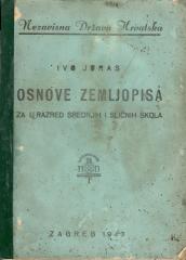
Osnove zemljopisa za I. razred srednjih i sličnih škola

Osnove zemljopisa za I. razred srednjih i sličnih škola

Ivo Juras

A general geography textbook intended for the first grade of secondary schools in the Independent State of Croatia. Contains the basics of physical and general geography, maps and illustrations. The work of the prominent Croatian geographer and pedagogue

Hrvatska državna tiskara, 1943.
Hrvatski. Latinica. Broširano.
7,34 €
Zemljopisni pregled Azije, Afrike, Amerike i Australije za niže razrede srednjih škola

Zemljopisni pregled Azije, Afrike, Amerike i Australije za niže razrede srednjih škola

Ivo Juras

A geography textbook for all continents (except Europe) intended for lower grades of secondary schools in the Independent State of Croatia. The work of the prominent Croatian geographer and pedagogue Ivo Juras, illustrated with interesting black-and-white

Hrvatska državna tiskara, 1942.
Hrvatski. Latinica. Broširano.
6,74 €
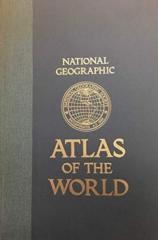
National Geographic Atlas of the World

National Geographic Atlas of the World

The fifth edition of the National Geographic Atlas of the World from 1981 is a monumental cartographic work. It contains detailed maps, satellite imagery, and geographic data from the height of the Cold War.

National Geographic Society, 1981.
Engleski. Latinica. Tvrde korice.
43,46 €