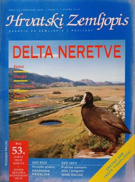
Hrvatski zemljopis # 53 - prosinac 2000: Delta Neretve
One copy is available

One copy is available
Are you interested in another book? You can search the offer using our search engine or browse books by category.
The author worked on the creation of historical atlases and maps that showed the development of Croatian lands through the centuries.
A rare interwar edition of a geography textbook (Belgrade, 1934) with 11 color atlas maps and 150 illustrations. Valuable as an antiquarian and cultural-historical document of education and cartography in the Kingdom of Yugoslavia.
The atlas contains thematic maps of the whole of Africa, physical maps of regions and Africa as a whole, and physical maps and basic data for each of the fifty-four states. There is an index of geographical names.
From The Penguin Atlas of World History that offers a unique combination of maps and illustrations with detailed chronological summary.