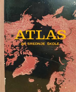
Atlas za srednje škole

Atlas za srednje škole

Urednik
Zvonimir Dugački, Zdravko Prelečec
Dimenzije
33 x 24 cm
Broj strana
107
Nakladnik
Učila - Kartografija, Zagreb, 1974.
 
Latinica. Tvrde korice.
Jezik: Hrvatski.

Jedan primjerak je u ponudi

Stanje:Korišteno, u dobrom stanju (tragovi korištenja)
Oštećenja / nepogodnosti:
  • Cracked back
  • A message of a personal nature
Dodano u košaricu!
 

Zanima Vas i neka druga knjiga? Možete pretražiti našu ponudu pomoću tražilice ili prelistati knjige po kategorijama.

Možda će Vas zanimati i ovi naslovi

Zašto je Zemlja tako posebna?

Zašto je Zemlja tako posebna?

Crispin Boyer

WHY do rainbows form? Why are leaves green? Why does the Earth spin fastest at the equator? Why can't they dig a path to the other side of the earth? Why is the sea salty? Why do we ask why? Because we always want to learn something new!

Egmont, 2019.
Hrvatski. Latinica. Tvrde korice.
3,30
Geografski atlas svijeta - za škole i dom

Geografski atlas svijeta - za škole i dom

Denis Šehić, Demir Šehić
Europapress holding, 2005.
Hrvatski. Latinica. Tvrde korice.
3,24
Grosser Autoatlas Europa: 1:800000

Grosser Autoatlas Europa: 1:800000

Freytag & Berndt, 2011.
Hrvatski. Latinica. Tvrde korice.
9,74
Slike iz obćega zemljopisa. Knjiga V., dio I.: Rusija

Slike iz obćega zemljopisa. Knjiga V., dio I.: Rusija

Ivan Hoić

Pictures from General Geography. Book V., Part I.: Russia is a geographical work by Ivan Hoić that provides a systematic overview of the Russian Empire, its natural features, population, economy, and culture.

Matica hrvatska, 1898.
Hrvatski. Latinica. Broširano.
17,46
Zemljopisni pregled Azije, Afrike, Amerike i Australije za niže razrede srednjih škola

Zemljopisni pregled Azije, Afrike, Amerike i Australije za niže razrede srednjih škola

Ivo Juras

A geography textbook for all continents (except Europe) intended for lower grades of secondary schools in the Independent State of Croatia. The work of the prominent Croatian geographer and pedagogue Ivo Juras, illustrated with interesting black-and-white

Hrvatska državna tiskara, 1942.
Hrvatski. Latinica. Broširano.
6,74
Geografija - s ilustrovanom geografskom čitankom, za treći razred građanskih škola

Geografija - s ilustrovanom geografskom čitankom, za treći razred građanskih škola

A rare interwar edition of a geography textbook (Belgrade, 1934) with 11 color atlas maps and 150 illustrations. Valuable as an antiquarian and cultural-historical document of education and cartography in the Kingdom of Yugoslavia.

IP Narodna prosveta, 1934.
Srpski. Ćirilica. Tvrde korice.
18,36