Veliki atlas Hrvatske
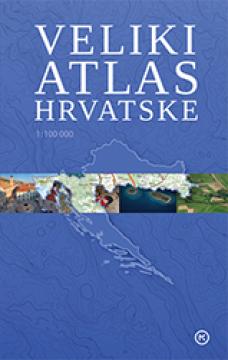
The Great Atlas of Croatia provides an overview of the natural, historical, economic and social features of Croatia through detailed maps, photographs and overview texts. The first Croatian topographic atlas at a scale of 1:100,000.
The Great Atlas of Croatia, published by Mozaik Knjige (2012), is a comprehensive cartographic and encyclopedic work that provides a detailed overview of the Republic of Croatia. The atlas combines modern geographical maps, rich photographic contributions and overview texts that introduce the reader to the natural, historical, cultural, demographic and economic features of the country.
In addition to precise descriptions of the relief, river systems, climatic features, transport infrastructure and administrative divisions, the edition also provides information on national parks, nature parks, cultural heritage, important cities and the development of Croatian regions. Special attention has been paid to the clarity of the presentation and ease of navigation, which is why the atlas is suitable for pupils, students, teachers, travellers, but also all lovers of geography and Croatia.
High-quality printing, a clear layout of the content and detailed maps make this edition a valuable source of information for everyday use, education and travel planning. The Great Atlas of Croatia is a reliable reference publication that brings together in one place the most important data about the Croatian region, its natural beauty, population, and cultural and historical heritage.
Jedan primerak je u ponudi