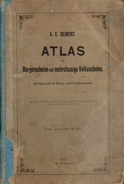
Atlas für Bürgerschulen und mehrklassige Volksschulen
Školski atlas Antona Emanuela Zajberta za građanske i višerazredne osnovne škole, objavljen u Beču oko 1901. godine. Sadrži 19 glavnih i 12 pomoćnih karata Evrope i sveta, kao i prikaze Austrougarske.
Atlas za građanske škole i višeklasne narodne škole je školski geografski atlas austrijskog geografa i pedagoga Antona Emanuela Zajberta, namenjen nastavi geografije u građanskim i višerazrednim javnim školama Austrougarske monarhije. Atlas je objavljen u Beču početkom 20. veka od strane ugledne izdavačke kuće Eduard Helcel Verlag, jednog od vodećih evropskih izdavača školskih atlasa i geografskih karata.
Atlas sadrži 19 glavnih karata i 12 pomoćnih karata, a njegovu upotrebu je odobrilo Carsko i kraljevsko ministarstvo za bogosluženje i prosvetu 29. avgusta 1901. godine. Cena povezanog primerka bila je 2,50 kruna.
Atlas je zamišljen kao sveobuhvatni pregled sveta i Austrougarske monarhije u to vreme. Prve karte prikazuju Zemljine hemisfere, fizičku geografiju Evrope i političku kartu Evrope. Poseban naglasak je stavljen na Austro-Ugarsku, kojoj je posvećeno sedam karata, koje prikazuju reljef, rečne sisteme, političke podele i pojedinačne pokrajine. Obuhvaćeni su austrijski alpski regioni, Beč sa okolinom, Sudeti, Krajska, Primorje, Dalmacija, Bosna i Hrvatska-Slavonija. Među pomoćnim kartama je i jezička karta Austro-Ugarske, vredan istorijski prikaz etničke i jezičke raznolikosti Monarhije.
Dalje karte prikazuju Nemačko carstvo, Skandinaviju, Rusiju, zemlje Zapadne i Južne Evrope, Aziju, Afriku, Australiju i Okeaniju i obe Amerike. Pomoćne karte pokrivaju određene važne regione kao što su Palestina, delta Nila, Južna Afrika, istočne države SAD i jugoistočna Australija.
Atlas je vredan primer školske kartografije s početka 20. veka i značajan istorijski izvor za proučavanje geografskog obrazovanja, političkih granica i pogleda na svet tokom perioda Austro-Ugarske monarhije. Zbog sadržaja koji obuhvata današnju teritoriju Hrvatske, Bosne i Hercegovine i drugih zemalja srednje Evrope, atlas ima i posebnu regionalnu kulturnu i istorijsku vrednost.
Jedan primerak je u ponudi
- Oštećene korice
- Pohabane korice