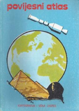
Povijesni atlas

Povijesni atlas

Josip Lučić

The author worked on the creation of historical atlases and maps that showed the development of Croatian lands through the centuries.

His works were important for understanding territorial changes and historical boundaries.

Editor
Zdravko Prelčec
Graphics design
Jože Rebernak
Dimensions
29 x 20 cm
Pages
77
Publisher
Učila - Kartografija, Zagreb, 1982.
 
Latin alphabet. Hardcover.
Language: Croatian.

One copy is available

Condition:Used, excellent condition
Damages or inconvenience notice:
  • Signature of previous owner
 

Are you interested in another book? You can search the offer using our search engine or browse books by category.

You may also be interested in these titles

Fiskovićev zbornik I-II : zbornik radova posvećenih sedamdesetogodišnjici života Cvita Fiskovića

Fiskovićev zbornik I-II : zbornik radova posvećenih sedamdesetogodišnjici života Cvita Fiskovića

Branko Kirigin, Marin Zaninović, Jasna Jeličić, Emilio Marin, Nenad Cambi, Nikola Jakšić, Nikša P...

A collection of papers dedicated to the seventieth anniversary of the life of art historian Cvito Fisković.

Književni krug, 1980.
Croatian. Latin alphabet. Hardcover with dust jacket.
The book consists of two volumes
12.00 - 25.46
Atlas für Bürgerschulen und mehrklassige Volksschulen

Atlas für Bürgerschulen und mehrklassige Volksschulen

Anton E. Seibert

School atlas by Anton Emanuel Seibert for civic and multi-grade elementary schools, published in Vienna around 1901. Contains 19 main and 12 auxiliary maps of Europe and the world, as well as depictions of Austria-Hungary.

Eduard Hölzel Verlag, 1901.
Croatian. Latin alphabet. Hardcover.
54.36
Školski atlas

Školski atlas

Alfa, 2000.
Croatian. Latin alphabet. Hardcover.
9.24
Zemljopisni atlas svijeta

Zemljopisni atlas svijeta

Alfonso Cvitanović

Westermann geographical atlas of the world, Earth and space, countries of the world

Mladost, 1989.
Croatian. Latin alphabet. Hardcover.
10.16
Autoatlas Europe

Autoatlas Europe

Vid Jakša Opačić

The Atlas offers detailed and updated maps of roads, highways, main thoroughfares, but also smaller regional roads in European countries.

Mozaik knjiga, 2008.
Croatian. Latin alphabet. Hardcover.
7.98
Geografija - s ilustrovanom geografskom čitankom, za treći razred građanskih škola

Geografija - s ilustrovanom geografskom čitankom, za treći razred građanskih škola

A rare interwar edition of a geography textbook (Belgrade, 1934) with 11 color atlas maps and 150 illustrations. Valuable as an antiquarian and cultural-historical document of education and cartography in the Kingdom of Yugoslavia.

IP Narodna prosveta, 1934.
Serbian. Cyrillic alphabet. Hardcover.
18.36