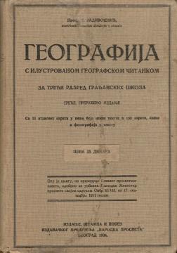
Geografija - s ilustrovanom geografskom čitankom, za treći razred građanskih škola
A rare interwar edition of a geography textbook (Belgrade, 1934) with 11 color atlas maps and 150 illustrations. Valuable as an antiquarian and cultural-historical document of education and cartography in the Kingdom of Yugoslavia.
Geography – with an illustrated geography textbook (third, revised edition) is a prominent interwar school work that combines a textbook and a textbook for the 3rd grade of civic schools. The book is characterized by rich visual equipment: 11 atlas maps in multiple colors outside the text and 150 maps, sketches and photographs within the text, which was a top didactic standard for that time. In terms of content, it covers the basic concepts of physical geography (relief, waters, climate, soils) and systematically leads from local examples to the European and global framework, with an emphasis on natural units, transport, resources, settlements and economic activities of the then Yugoslavia.
The antiquarian and cultural-historical value of this edition is multiple. As an original document of the education system of the Kingdom of Yugoslavia, it testifies to the pedagogical methods of the 1930s, the standards of cartographic reproduction in color and the emphasized role of visual learning.
For libraries, researchers and collectors of the history of education and cartography, this edition represents a reference example of interwar school geography with high documentary integrity. In a well-preserved and complete condition, such as this one on offer, the book is a representative segment of any collection dedicated to the Yugoslav pedagogical and publishing heritage, and a valuable source for the study of visual practices and curriculum of that time.
One copy is available
- Stains on cover